Mountains, Ranges & Passes of India
TGPRB Constable / SI · 2-4 direct questions per paper. Master the Himalayan ranges (KLZPS), North-to-South peak order, major mountain passes, Western & Eastern Ghats, and Peninsular block mountains.
How TGPRB tests this topic
Cover all six and you master every question TGPRB has ever asked about mountains, relief divisions, passes, and peaks.
Predicted 2026 Question Patterns
Primary Format: North-to-South Chronological Ordering of Ranges (Karakoram -> Ladakh -> Zaskar -> Pir Panjal -> Shivalik) and Match the Following (Pass ↔ State / Range and Peak ↔ Mountain System). Watch out for the trap between Anamudi (highest in South India) vs Dodda Betta (highest in Nilgiris).
The Visual Architecture
India's orography is divided into two major macro-systems: the young tertiary Himalayan Fold Mountains in the north (created by the collision of the Indian and Eurasian tectonic plates) and the ancient relict Peninsular Block & Ghat Ranges in the south (Pre-Cambrian crystalline shields).
Master Physical Map: Mountain Ranges & Plateaus of India
Comprehensive spatial locator: Himalayas, Aravallis, Vindhyas, Satpura, Western & Eastern Ghats
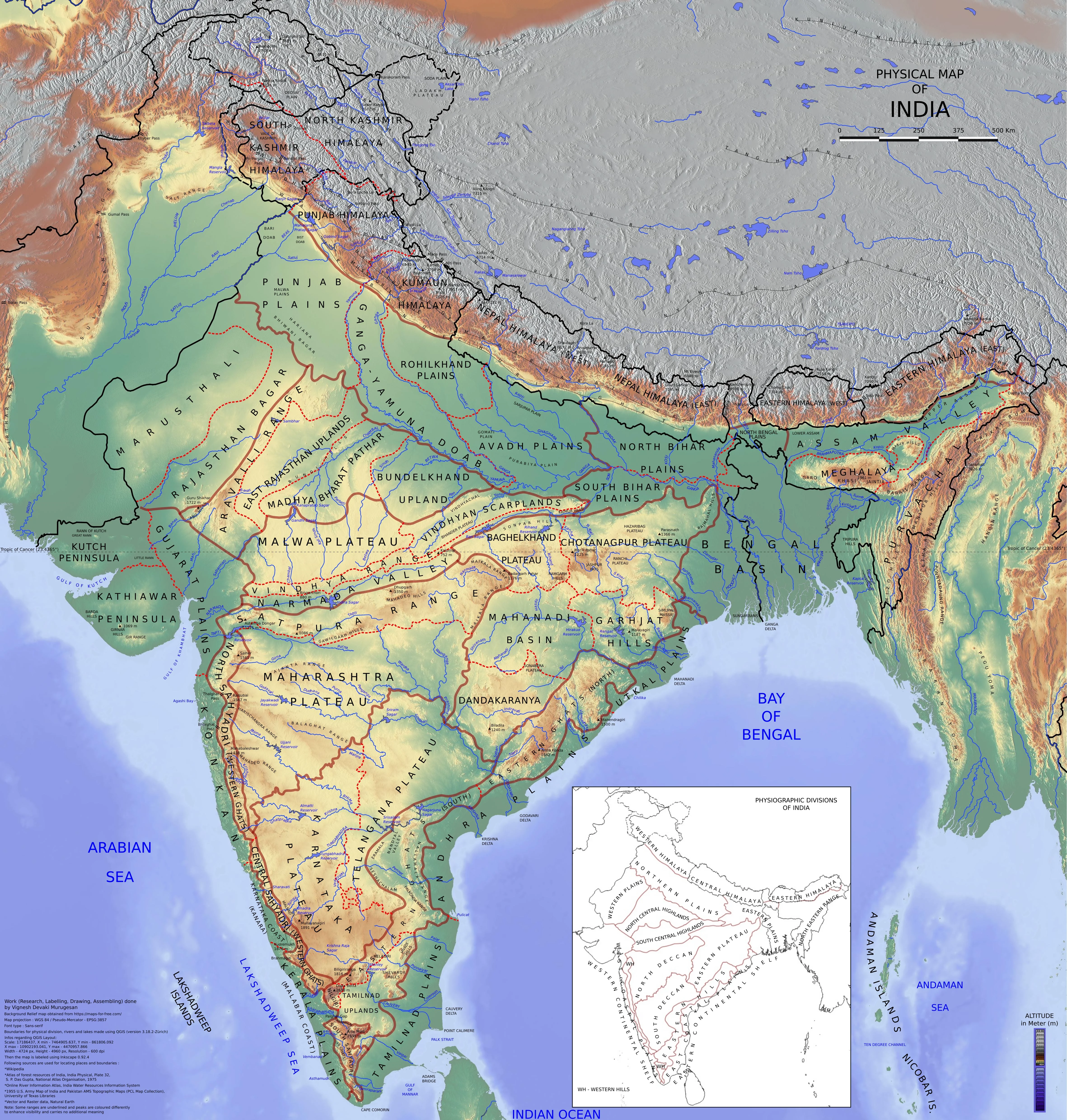
Himalayan & Trans-Himalayan Parallel Systems
KLZPS Order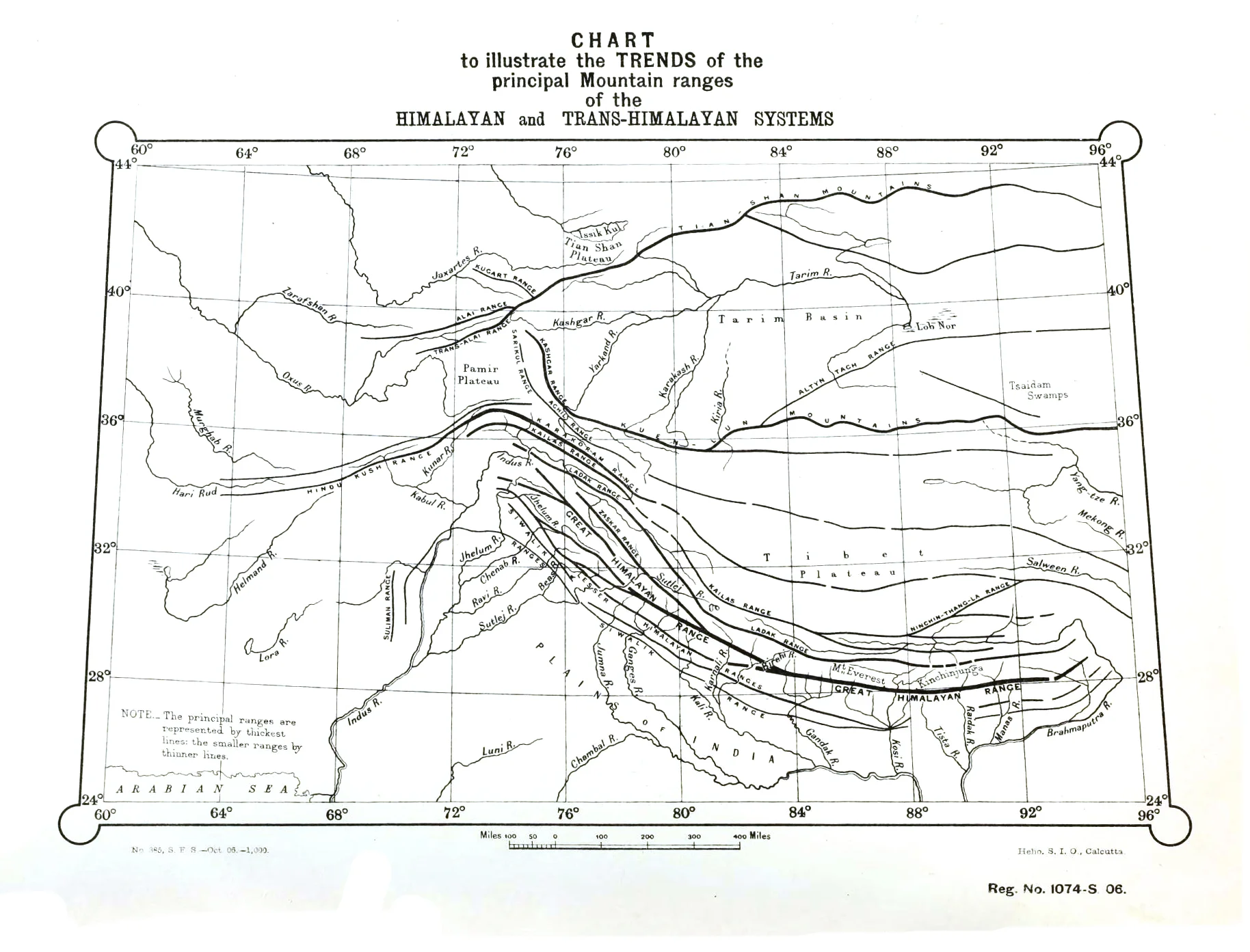
North-to-South Order: Karakoram -> Ladakh -> Zaskar -> Great Himalaya -> Pir Panjal / Lesser Himalaya -> Siwalik.
Himalayan Passes & Eight-Thousander Summits
Passes & Summits
Master Locator: Trans-Himalayan KLZPS pass connectivity (Zoji La, Rohtang, Nathu La) and 8,000m summits hierarchy.
Himalayan Ranges: North-to-South Sequential Order
Tested in TGPRB sequence questions (Mnemonic: K L Z P D S)
Karakoram Range
Trans-Himalayas
Home to K2 (8,611 m) and Siachen Glacier (longest glacier outside polar realms).
Ladakh Range
Trans-Himalayas
Lies between Indus & Shyok rivers. Highest peak: Mt. Rakaposhi (steepest slope on Earth).
Zaskar Range
Trans / Greater
Lies south of Indus river valley. Highest peak: Kamet (7,756 m) in Garhwal.
Pir Panjal / Dhauladhar
Lesser Himalayas
Longest range of Lesser Himalayas. Hosts Kashmir Valley & Karewas saffron terraces.
Shivalik Range
Outer Himalayas
Youngest southernmost range. Forms longitudinal valleys called 'Duns' (Dehradun).
Peninsular Ranges & Highest Peaks Summary
Hierarchy at a glance
MOUNTAINS OF INDIA (Macro Structure & Spatial Order)
|-- 1. TRANS-HIMALAYAS (North of Great Himalayas)
|   |-- Karakoram Range  -> K2 / Godwin Austen (8,611 m) | Siachen Glacier
|   |-- Ladakh Range     -> Between Indus & Shyok | Khardung La
|   +-- Zaskar Range     -> Between Indus & Great Himalayas | Kamet (7,756 m)
|
|-- 2. HIMALAYAN SYSTEM (Tertiary Fold Mountains)
|   |-- Greater Himalayas (Himadri)  -> Everest (8,848.86 m), Kanchenjunga (8,586 m), Nanda Devi (7,816 m)
|   |-- Lesser Himalayas (Himachal) -> Pir Panjal (longest), Dhauladhar, Mahabharat | Karewas Saffron Soil
|   |-- Outer Himalayas (Shivalik)  -> Youngest range | Duns / Doons (Dehradun) | Mishmi Hills in AP
|   +-- Purvanchal (Eastern Hills)  -> Patkai Bum, Naga Hills, Mizo (Lushai) Hills
|
|-- 3. PENINSULAR MOUNTAIN RANGES
|   |-- Aravalli Range   -> Oldest relict fold mountain | Guru Shikhar (1,722 m, Mt Abu)
|   |-- Vindhya Range    -> North of Narmada rift | Watershed between Ganga & Peninsular rivers
|   |-- Satpura Range    -> Horst block between Narmada & Tapi | Dhupgarh (1,350 m, Mahadeo Hills)
|   |-- Western Ghats    -> Continuous escarpment | Anamudi (2,695 m, highest in South India)
|   |-- Eastern Ghats    -> Discontinuous broken ranges | Jindhagada Peak (1,690 m) / Mahendragiri
|   +-- Nilgiri Hills    -> Western & Eastern Ghats junction knot | Dodda Betta (2,637 m)
Introduction
The physiography of India is anchored by mountain systems of two entirely different geological eras: the Himalayan Arc (young, flexible, tertiary fold mountains stretching 2,400 km from the Indus gorge in the west to the Brahmaputra gorge at Namcha Barwa in the east) and the Peninsular Plateau Mountain Ranges (rigid, ancient Pre-Cambrian block mountains and denuded relict ridges).
Why this topic matters for TGPRB
34 verified PYQs across Constable + SI papers (2015-2023). Expect 2-4 direct questions per paper. Top question types: North-to-South range sequencing (Karakoram to Shivalik), state-wise pass connections (Zoji La, Shipki La, Nathu La, Palghat), peak superlatives (Anamudi vs Dodda Betta), and geological landforms (Duns and Karewas).
The Himalayas act as a formidable climatic barrier, intercepting the moisture-laden South-West Monsoons to produce torrential rainfall across the Gangetic plains while shielding the Indian subcontinent from the frigid Siberian blizzards. Geologically, they were formed when the drifting Indian tectonic plate collided with the Eurasian plate, uplifting the sediments deposited in the ancient Tethys Sea geosyncline.
Deep Dive
Master the 3 parallel Himalayan belts, regional river boundaries, strategic mountain passes, and the Peninsular mountain framework.
1. The Three Longitudinal Belts of the Himalayas
The Himalayas consist of three parallel mountain ranges running from west to east:
A. Greater Himalayas (Himadri / Inner Himalayas)
Avg Height: ~6,000 mThe most continuous, loftiest range on Earth. Composed of core crystalline granite rocks. Covered with permanent snow. Contains all the highest peaks: Mt. Everest (8,848.86 m, Nepal), Kanchenjunga (8,586 m, Sikkim - highest in India), Makalu (8,481 m), Dhaulagiri (8,172 m), Nanga Parbat (8,126 m), Annapurna (8,091 m), and Nanda Devi (7,816 m, Uttarakhand).
B. Lesser Himalayas (Himachal / Middle Himalayas)
Avg Height: 3,700-4,500 mRugged and heavily compressed metamorphic rocks. Contains prominent sub-ranges: Pir Panjal Range (longest and most important), Dhauladhar Range (Himachal Pradesh), Nag Tibba, and Mahabharat Range (Nepal). Famous hill stations: Shimla, Mussoorie, Nainital, Ranikhet, Darjeeling.
Thick lacustrine (lake silt and clay) formations found along the lower slopes of the Pir Panjal Range in Kashmir Valley. Famous for cultivating Zafran (Saffron), walnuts, and almonds.
C. Outer Himalayas (Shivalik Hills)
Avg Height: 900-1,100 mYoungest, outermost range composed of unconsolidated river sediments, gravel, and alluvium. Highly prone to earthquakes and landslides. In Arunachal Pradesh, Shivaliks are known as Dafla, Miri, Abor, and Mishmi Hills.
Longitudinal structural valleys formed between the Lesser Himalayas (Himachal) and Outer Himalayas (Shivalik). Examples: Dehradun (largest, ~35 km long), Kotli Dun, and Patli Dun.
Regional Divisions of the Himalayas (Demarcated by River Valleys)
| Division | River Boundaries | Key Ranges & Peaks | Key States / Regions |
|---|---|---|---|
| Punjab / Kashmir Himalaya | Between Indus and Sutlej | Karakoram, Ladakh, Zaskar, Pir Panjal | J&K, Ladakh, Himachal Pradesh |
| Kumaon Himalaya | Between Sutlej and Kali | Nanda Devi, Kamet, Trishul, Badrinath, Kedarnath | Uttarakhand |
| Nepal Himalaya | Between Kali and Teesta | Mt. Everest, Kanchenjunga, Makalu, Annapurna | Nepal, Sikkim, Northern West Bengal |
| Assam Himalaya | Between Teesta and Dihang (Brahmaputra) | Namcha Barwa, Kula Kangri | Arunachal Pradesh, Assam, Bhutan |
Himalayan Peak Photography & Geomorphic Landforms
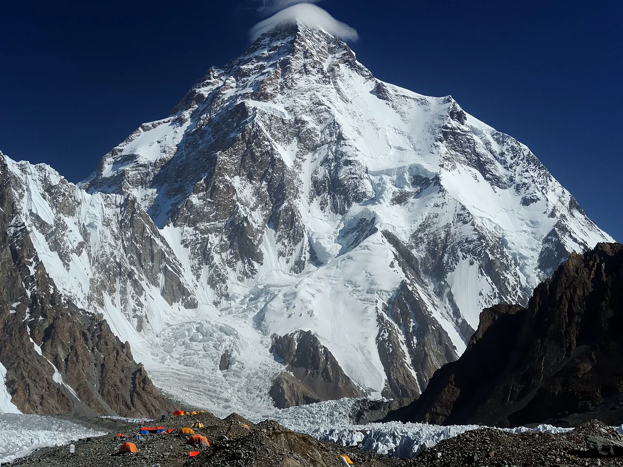
K2 (Godwin Austen)
Karakoram Range · 2nd highest peak in the world.
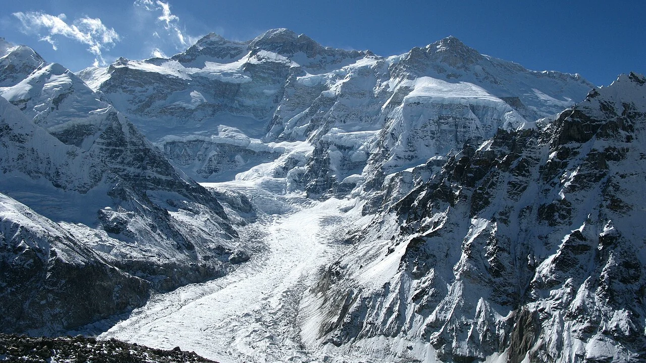
Kangchenjunga
Sikkim-Nepal border · Highest peak in Indian territory.
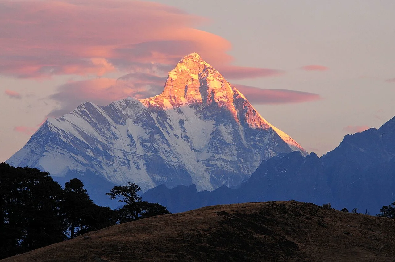
Nanda Devi
Garhwal Himalayas · Highest peak entirely within India.
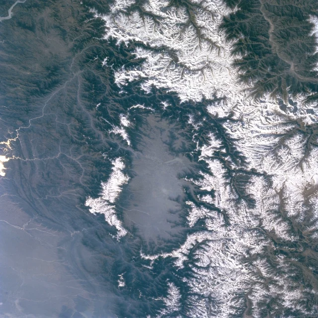
Karewas of Kashmir
Pir Panjal slopes · Saffron & almond cultivation.
2. Strategic Mountain Passes of India
State ↔ Mountain Pass ↔ Connected Regions tested in TGPRB match-the-following questions:
Himalayan Mountain Passes & Eight-Thousanders (TSLPRB / TGPRB Master Reference)
| Pass Name | State / UT | Mountain Range | Connects / Strategic Significance |
|---|---|---|---|
| Zoji La | Ladakh / J&K | Great Himalayas | Srinagar to Leh (NH 1D). Gateway to Ladakh. |
| Banihal Pass | Jammu & Kashmir | Pir Panjal Range | Jammu to Srinagar. Contains the historic Jawahar Tunnel. |
| Shipki La | Himachal Pradesh | Zaskar Range | Connects HP with Tibet. Sutlej River enters India through this pass gorge. |
| Rohtang Pass | Himachal Pradesh | Pir Panjal Range | Connects Kullu Valley with Lahaul and Spiti. Underneath lies the 9.02 km Atal Tunnel. |
| Bara-lacha La | Himachal Pradesh | Zaskar Range | Connects Lahaul (HP) with Leh (Ladakh) on the Manali-Leh Highway. |
| Lipulekh Pass | Uttarakhand | Kumaon Himalayas | Tri-junction of India-China-Nepal. Key route for Kailash-Mansarovar Yatra. |
| Mana & Niti Passes | Uttarakhand | Great Himalayas | Connects Uttarakhand (Garhwal) to Tibet. Mana is the last Indian village before Tibet. |
| Nathu La | Sikkim | Dongkya Range | Connects Sikkim with Tibet (Chumbi Valley). Part of the ancient Silk Route. Reopened in 2006. |
| Jelep La | Sikkim | Great Himalayas | Connects Sikkim and Kalimpong (WB) with Lhasa (Tibet) via Chumbi Valley. |
| Bomdi La | Arunachal Pradesh | Greater Himalayas | Connects Arunachal Pradesh (Tawang) with Lhasa (Tibet). |
| Diphu Pass | Arunachal Pradesh | Mishmi Hills | Strategic tri-junction border pass of India, China, and Myanmar. |
| Thal Ghat (Kasara) | Maharashtra | Western Ghats (Sahyadri) | Connects Mumbai to Nashik and Kolkata. |
| Bhor Ghat | Maharashtra | Western Ghats (Sahyadri) | Connects Mumbai to Pune and Chennai. |
| Palghat Gap (Palakkad) | Kerala / Tamil Nadu | Between Nilgiris & Anamalai | Connects Palakkad (Kerala) with Coimbatore (TN). Breaks continuity of Western Ghats. |
| Shencottah Gap | Kerala / Tamil Nadu | Cardamom Hills | Connects Kollam (Kerala) with Madurai (TN). |
Strategic Mountain Passes Gallery
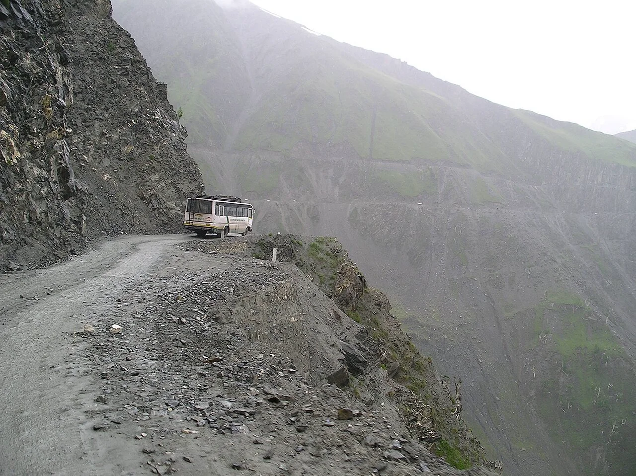
Zoji La (Ladakh)
Srinagar to Leh highway across Great Himalayas.
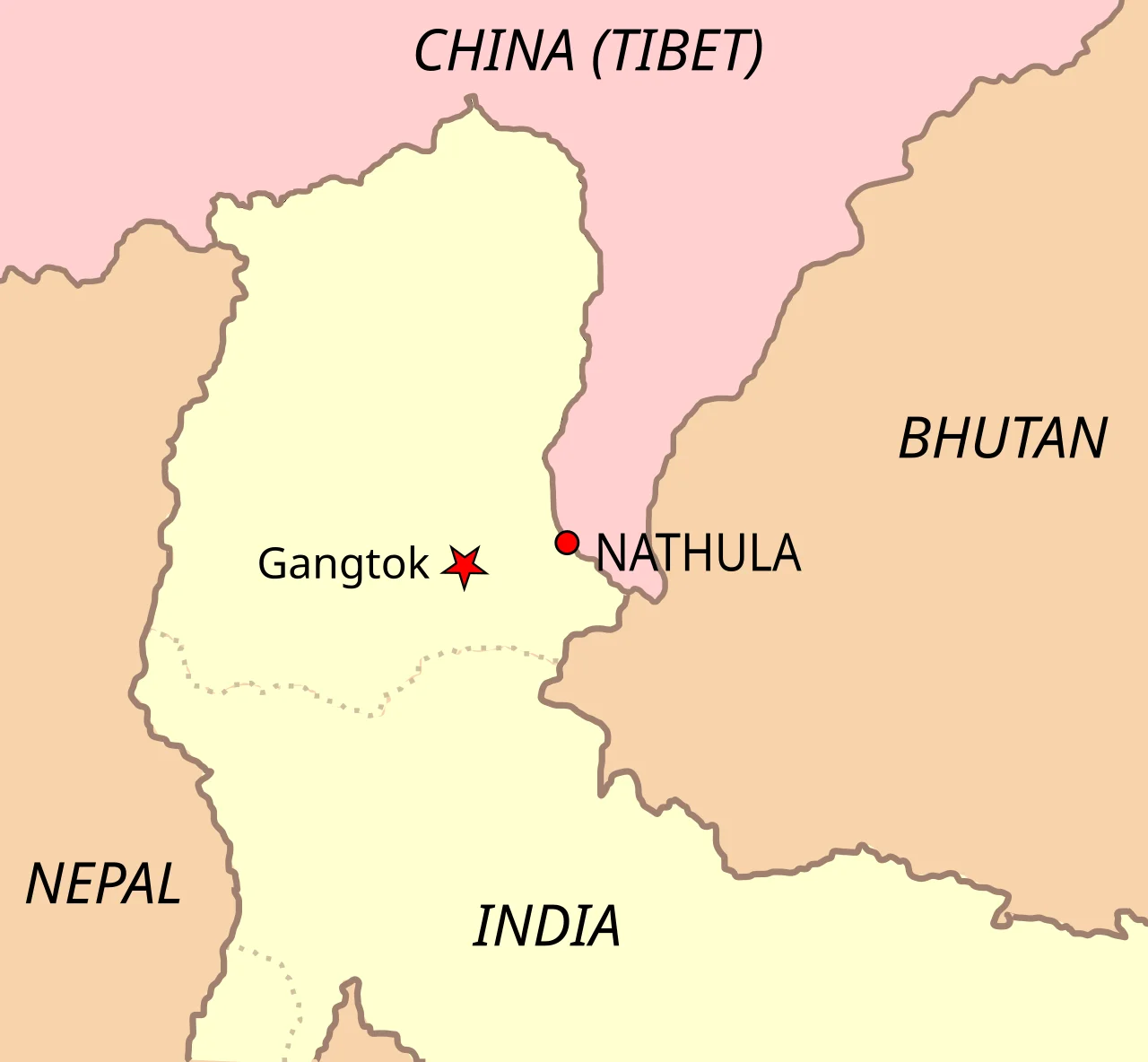
Nathu La (Sikkim)
Ancient Silk Route into Chumbi Valley of Tibet.
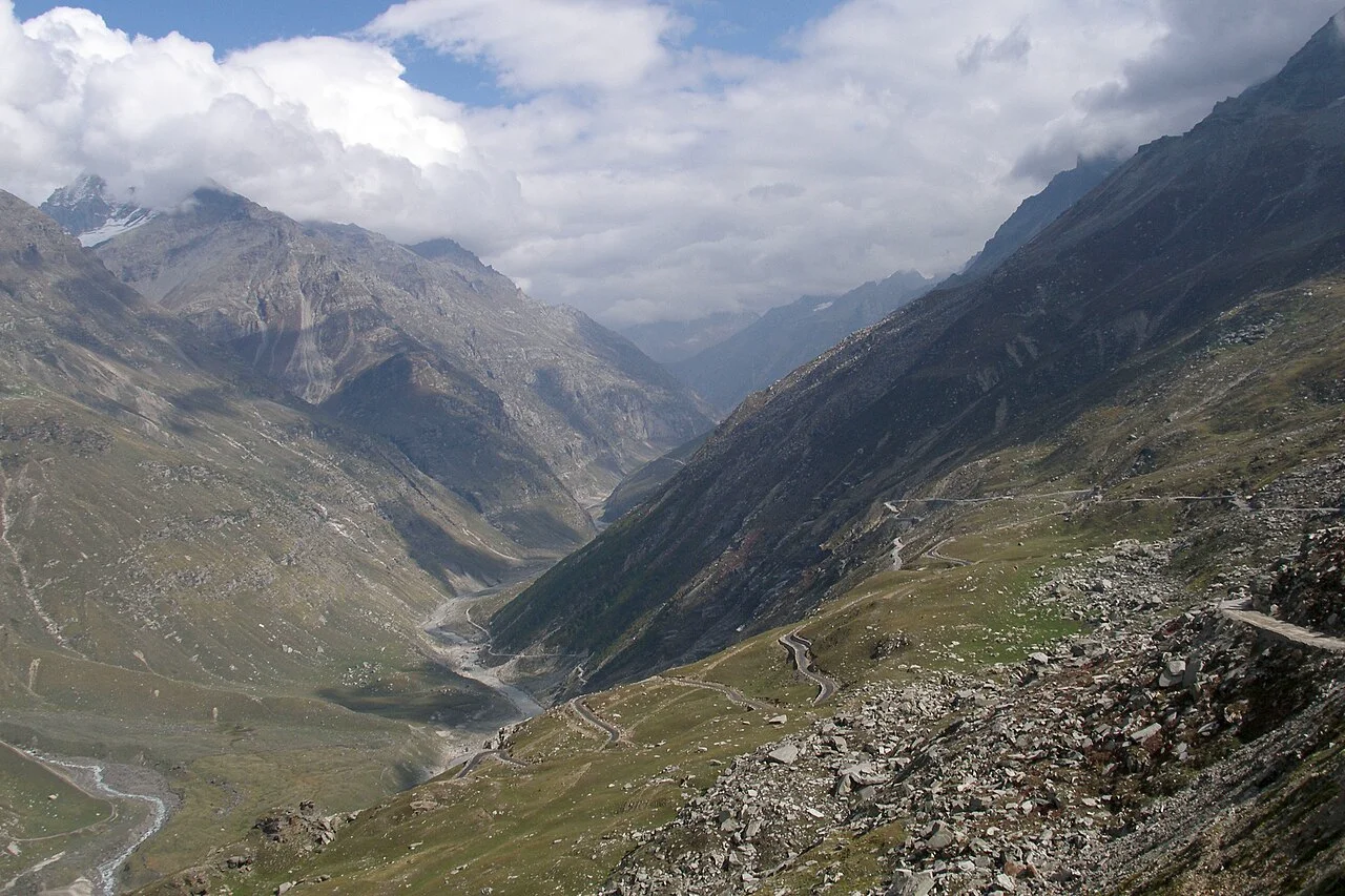
Rohtang Pass (HP)
Pir Panjal Range · Connects Kullu with Lahaul-Spiti.
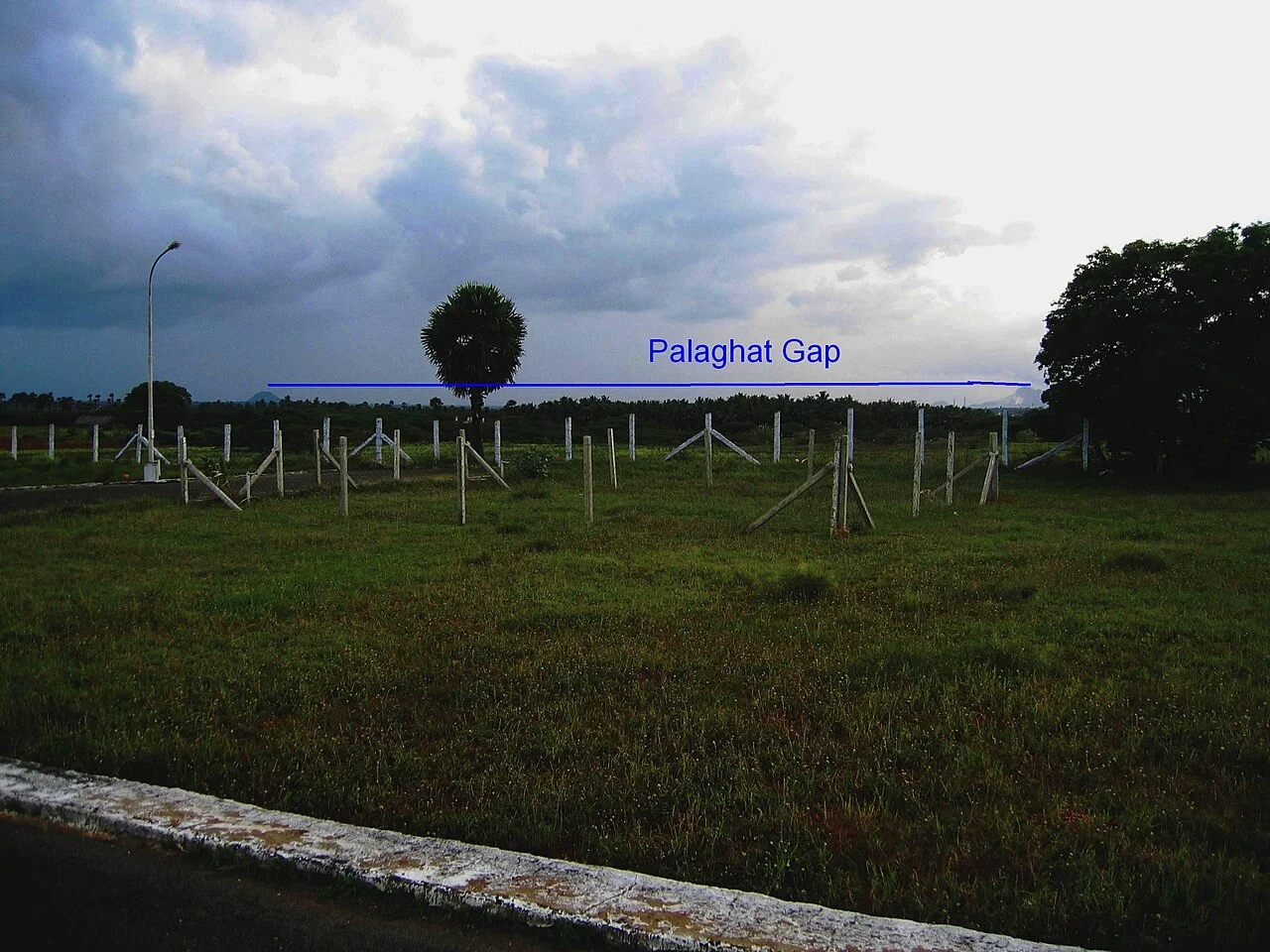
Palghat Gap (South)
Major natural break between Nilgiris and Anamalai Hills.
3. Peninsular Mountain Ranges & Coastal Ghats
Aravalli Range
One of the oldest fold mountain systems in the world (Pre-Cambrian). Extends ~800 km from Gujarat (Palanpur) through Rajasthan and Haryana to Delhi (Delhi Ridge / Raisina Hill). Highest peak is Guru Shikhar (1,722 m) located on Mount Abu. Contains famous Dilwara Jain Temples.
Vindhya Range
Runs parallel to the north of the Narmada River rift valley across Madhya Pradesh and Uttar Pradesh. Composed of sedimentary sandstones. Acts as the primary geographical divide between Northern India (Ganga Basin) and Southern India (Peninsula). Highest point: Sadbhavna Shikhar / Kalumar Peak (752 m).
Satpura Range
A classic horst/block mountain range lying between two rift valleys: Narmada to the north and Tapi to the south. Subdivided into: Rajpipla Hills (west) -> Mahadeo Hills (central) -> Maikal Range (east). Highest peak is Dhupgarh (1,350 m) located in Mahadeo Hills near Pachmarhi. Amarkantak plateau (Maikal Range) is the radial source of Narmada, Son, and Johilla rivers.
Nilgiri Hills (Blue Mountains)
The physiological knot where the Western Ghats and Eastern Ghats converge. Tri-junction of Tamil Nadu, Kerala, and Karnataka. Highest peak is Dodda Betta (2,637 m) (second highest peak in South India). Famous hill station: Ooty (Udhagamandalam). Hosts Toda tribal community.
Peninsular Peaks & Hill Ranges Gallery
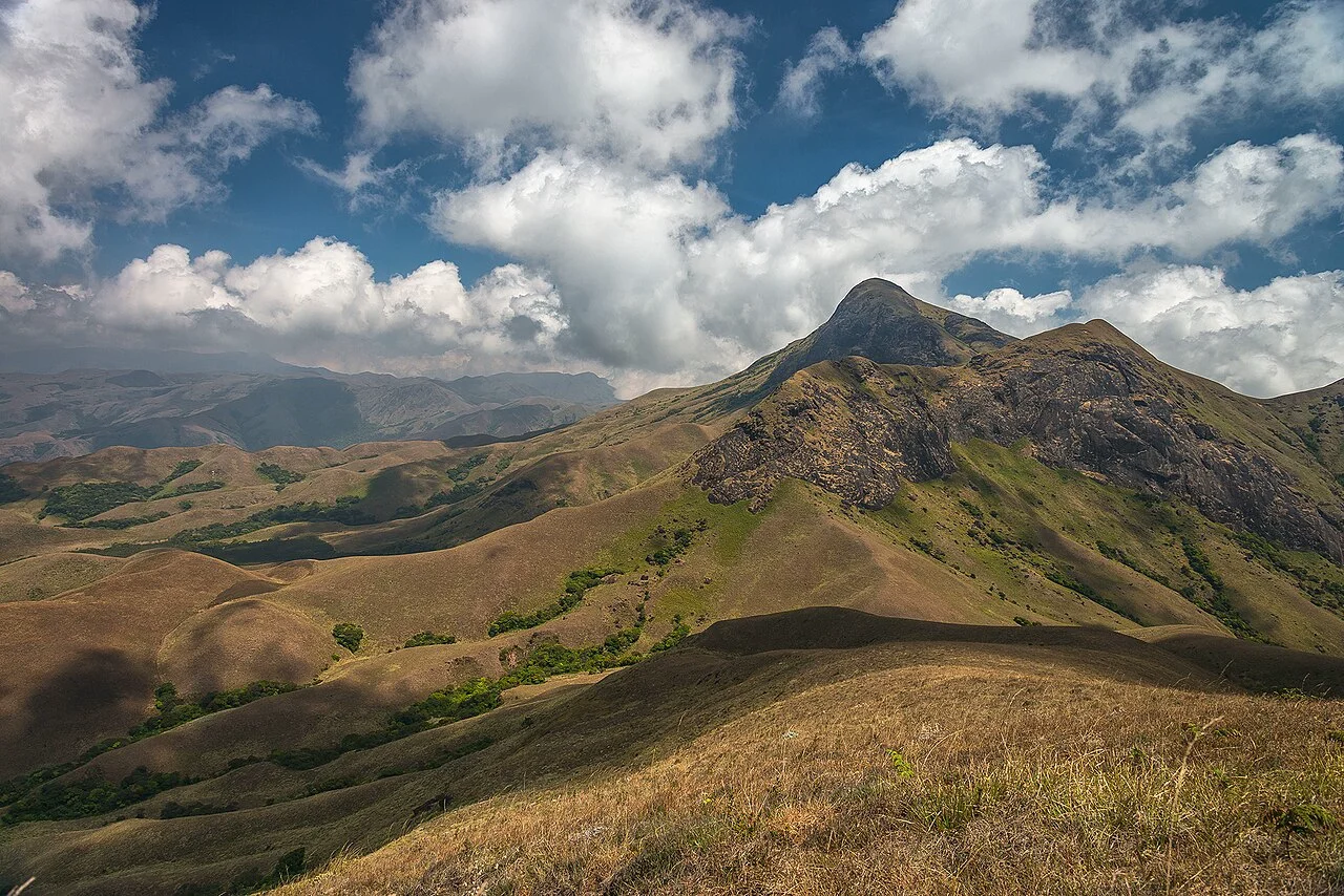
Anamudi Peak
Anamalai Hills (Kerala) · Highest point of Peninsular India.
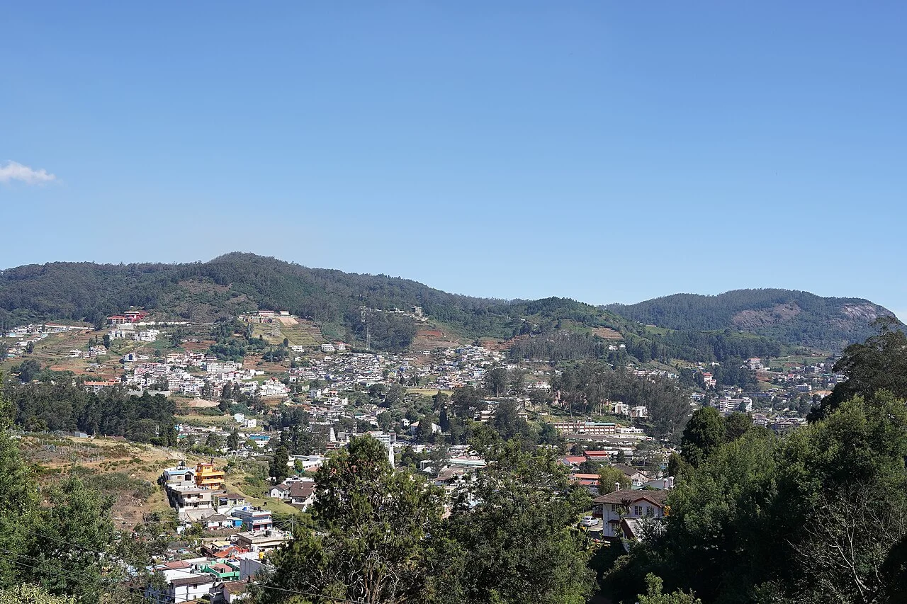
Dodda Betta
Nilgiri Hills (Tamil Nadu) · 2nd highest peak in South India.
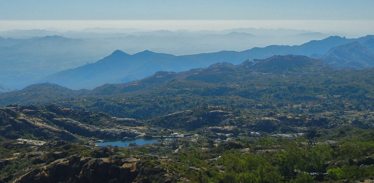
Guru Shikhar
Mount Abu (Rajasthan) · Highest summit of Aravalli Range.
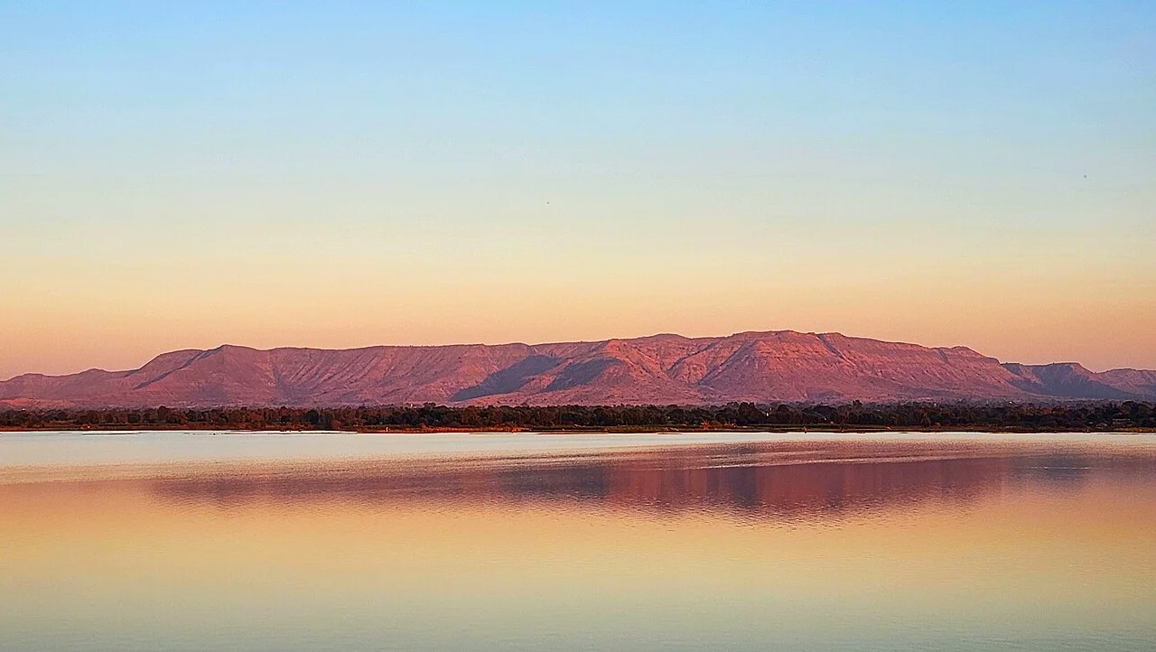
Satpura & Mahadeo
Pachmarhi (MP) · Horst block range between Narmada & Tapi.
Data & Comparisons
Master the contrastive distinctions between the Western Ghats and Eastern Ghats:
Western Ghats (Sahyadri) vs Eastern Ghats (Purva Ghat)
| Feature | Western Ghats (Sahyadri) | Eastern Ghats |
|---|---|---|
| Continuity | Continuous | Discontinuous & Dissected |
| Gaps / Passes | Passable only via gaps: Thal Ghat, Bhor Ghat, Palghat | Dissected by major rivers: Godavari, Krishna, Mahanadi, Cauvery |
| Average Elevation | 900-1,600 metres (Higher) | ~600 metres (Lower) |
| Highest Peak | Anamudi (2,695 m) in Anamalai Hills | Jindhagada Peak (1,690 m) in Araku Valley / Mahendragiri (1,501 m) |
| Rainfall Nature | Heavy orographic rain on windward side (200-400 cm) | Moderate rain, mostly during retreating NE Monsoon (Oct-Dec) |
| Ecological Status | UNESCO World Heritage Site · Global Biodiversity Hotspot | Heavily degraded, scattered hills (Javadi, Shevaroy, Nallamala, Velikonda) |
Highest Mountain Peaks in India by System
| Mountain System | Highest Peak | Elevation | Location / State | Key Distinction |
|---|---|---|---|---|
| Karakoram (Trans-Himalaya) | K2 (Godwin Austen) | 8,611 m | Ladakh (PoK) / Gilgit-Baltistan | 2nd highest peak in the world |
| Greater Himalayas (India) | Kangchenjunga | 8,586 m | Sikkim | Highest peak in undisputed Indian territory |
| Garhwal Himalayas (Pure India) | Nanda Devi | 7,816 m | Uttarakhand | Highest peak completely within Indian borders |
| Western Ghats / South India | Anamudi | 2,695 m | Kerala (Anamalai Hills) | Highest summit in Peninsular / South India |
| Nilgiri Hills | Dodda Betta | 2,637 m | Tamil Nadu | 2nd highest in South India; highest in Nilgiris |
| Aravalli Range | Guru Shikhar | 1,722 m | Rajasthan (Mount Abu) | Highest summit of the ancient Aravalli relict range |
| Eastern Ghats | Jindhagada / Arma Konda | 1,690 m | Andhra Pradesh (Visakhapatnam) | Highest peak of the discontinuous Eastern Ghats |
| Satpura Range | Dhupgarh | 1,350 m | Madhya Pradesh (Mahadeo Hills) | Highest peak of Central India block mountains |
Memory Hacks
Negative marking traps designed by exam setters to induce errors:
Trap 1: Anamudi vs Dodda Betta
• Anamudi (2,695 m): Located in Anamalai Hills (Kerala). Highest peak in all of South India / Peninsular India.
• Dodda Betta (2,637 m): Located in Nilgiri Hills (Tamil Nadu). Highest peak ONLY of the Nilgiris (2nd highest in South India).
Trap 2: Western Ghats Passes (North to South Order: T B P S)
Remember the formula T B P S:
1. T - Thal Ghat: Mumbai to Nashik (Northernmost)
2. B - Bhor Ghat: Mumbai to Pune
3. P - Palghat Gap: Palakkad (Kerala) to Coimbatore (TN)
4. S - Shencottah Gap: Kollam (Kerala) to Madurai (TN) (Southernmost)
Trap 3: Garo, Khasi, Jaintia Hills Are NOT Part of the Himalayas
The Garo, Khasi, and Jaintia Hills forming the Meghalaya (Shillong) Plateau are geologically an outlier extension of the Peninsular Deccan Plateau, separated by the Malda Fault (Garo-Rajmahal Gap). They are NOT fold mountains and are NOT part of the Himalayas or Purvanchal.
PYQs
Every question below appeared in an official TSLPRB Constable or SI paper. Click an option to test your understanding.
Consider the following ranges in Himalayas and find out the correct sequence from North to South: (a) Zaskar range (b) Pirpanjal range (c) Shivalik range (d) Ladakh range
Match the following List-I (a) Aravali Hills (b) Highest Peak of Nilgiris (c) Mahendragiri Hills (d) Western Ghats List-II (i) Eastern Ghats (ii) Kondesh Hills (iii) Dodda Betta (iv) Malwa plateau
Match the following : List-I (a) Siachen glacier (b) Bundi hills (c) Highest point of Satpura hills (d) Shivalik Range List-II (I) Malwa plateau (II) Mishmi Hills (III) Karakoram Range (IV) Mahadeo Hills
Karewas of Kashmir are generally found along the lower slopes of:
The longitudinal valleys also called Duns/Doons are found in :
Match the following: List - I (a) Guru Shikhar Peak (b) Dhuadhar waterfall (c) Thalghat gap (d) Coral reefs List - II (i) Lakshadweep islands (ii) Western ghats (iii) Narmada river (iv) Aravallis
Gosainthan peak is situated in :
Read the following statements (a) In Arunachal Pradesh, the Siwalik range of hills are called Mishimi hills. (b) Minicoy islands are located in the Arabian Sea. (c) Conifer wood is used as raw material to manufacture paper. The correct answer is
Match the following List - I a) Sardar Sarovar dam b) Highest mountain peak in South India c) Todas d) Copper List - II i) Anaimudi ii) Agnigundala iii) Narmada iv) Nilgiri
Match the following List-I (a) Banihal pass (b) Rohtang pass (c) Niti pass (d) Nathu La pass List-II (i) Jammu & Kashmir (ii) Himachal Pradesh (iii) Uttarakhand (iv) Sikkim Correct answer is
Advanced Practice
TGPSC-Style Advanced Practice
These questions use multi-statement, 4x4 matching, and assertion-reason formats from recent TGPSC Group-I patterns. TGPRB papers (2022-2023) remain 92-93.5% direct factual MCQs. These drills harden your spatial and conceptual recall.
Source: Forensic Paper-Setting Evolution Audit, Aug 2026 - 1,350 questions classified across 7 papers.
Consider the following two statements: Assertion (A): Orographic precipitation results when moving moisture-laden air strikes a topographic barrier and is forced upwards. Reason (R): Most of the precipitation falls on the windward side of the barrier and the leeward side is likely to be dry. Choose the correct answer:
Consider the following mountain ranges of the Trans-Himalayan and Himalayan systems. Arrange them in the correct North-to-South sequence: A. Zaskar Range B. Karakoram Range C. Pir Panjal Range D. Ladakh Range Choose the correct order:
Match the following strategic mountain passes with the regions/cities they connect: List I (Pass): A. Zoji La B. Shipki La C. Nathu La D. Thalghat List II (Connector): I. Himachal Pradesh to Tibet (Sutlej gorge) II. Mumbai to Nashik III. Srinagar to Leh (Ladakh) IV. Sikkim to Tibet (Chumbi Valley)
Consider the following statements regarding Peninsular mountain ranges: A. Anamudi (2,695 m) in the Anaimalai Hills is the highest peak in South India. B. Doddabetta (2,637 m) is the highest peak in the Nilgiri Hills where Western and Eastern Ghats meet. C. Guru Shikhar (1,722 m) in Mount Abu is the highest peak of the Satpura Range. D. Dhupgarh (1,350 m) near Pachmarhi is the highest peak of the Satpura Range. Which of the above statements are correct?
Which of the following statements comparing the Western Ghats and Eastern Ghats are correct? A. Western Ghats form an unbroken, continuous escarpment traversable only through passes like Thalghat and Bhorghat. B. Eastern Ghats are discontinuous and highly dissected by major East-flowing rivers like Godavari, Krishna, and Mahanadi. C. The average elevation of Eastern Ghats (1,500 m) is higher than that of Western Ghats (900-1,600 m). D. Western Ghats cause heavy orographic rainfall along their windward western slopes. Choose the correct answer:
Comprehension Gate
Current Affairs
Current Affairs (1/110)
Union Environment Minister releases two male Great Indian Bustards into the wild at Desert National Park, Jaisalmer
Two male Great Indian Bustards were released into the wild at Sam in the Desert National Park, Jaisalmer, Rajasthan by Union Minister Shri Bhupender Yadav.
Union Minister for Environment, Forest and Climate Change Shri Bhupender Yadav released two male critically endangered Great Indian Bustards (GIBs) into the wild at the Desert National Park in Jaisalmer, Rajasthan. The Bustard Recovery Programme is a collaborative initiative involving the Ministry, Rajasthan Forest Department, and the Wildlife Institute of India.