Irrigation in India & Telangana
TGPRB Constable / SI · 2–4 direct questions per paper. Learn the 4 sources, major canal headworks, multipurpose dams, and Telangana lift irrigation schemes.
How TGPRB tests this topic
Cover all six and you have everything TGPRB has ever asked about irrigation and dams here. Anything outside these six is context, not exam material.
Predicted 2026 Question Patterns
Primary Format: Match the Following (Project ↔ River / Dam) and 4-Statement True/False Verifications on Canal origins (Harike Barrage) and PMKSY components (Per Drop More Crop). Trap alert: Watch out for Tank vs Tube-well leading state traps.
The Visual Architecture
Irrigation in India is spatially divided: the Northern Alluvial Plains rely on Wells & Perennial Canals fed by Himalayan rivers; the Peninsular Plateau relies on Tanks & Multi-Stage Lift Irrigation due to impermeable hard basalt/granite rock.
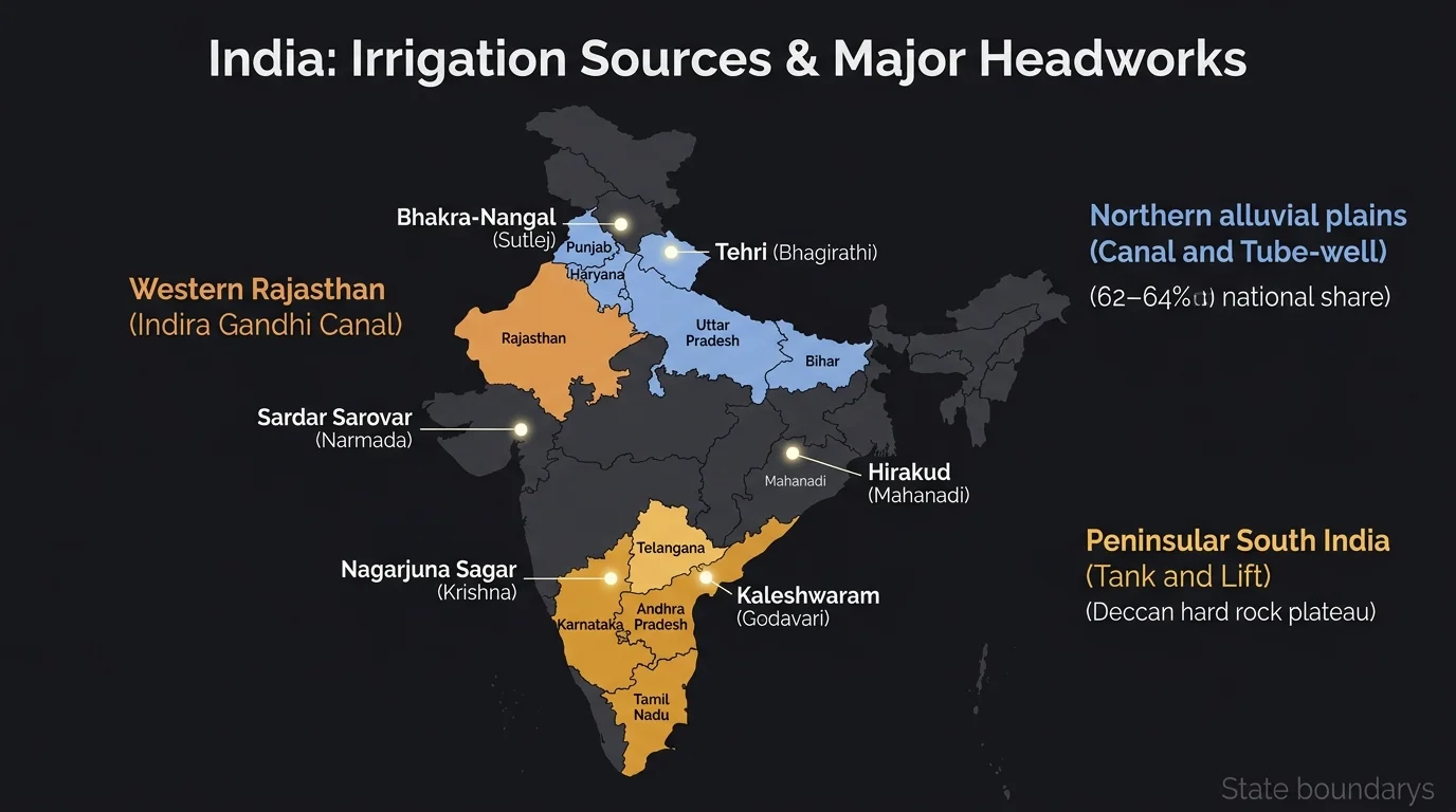
National Irrigation Sources & Canal Network Infrastructure
Macro percentages, state distributions, and key engineering headworks
62–64%
Wells & Tube-wells
Uttar Pradesh leads. Gangetic plain tube-wells + Deccan open dug wells.
24–26%
Canals
UP, Punjab, Haryana, Rajasthan. Indira Gandhi Canal (650 km from Harike).
3–4%
Tanks
Tamil Nadu, AP, Telangana. Deccan plateau hard rock terrain & natural bowls.
6–8%
Other / Lift
Multi-stage lift irrigation (Kaleshwaram), springs, water harvesting.
Source: 4th & 5th Minor Irrigation Census, Ministry of Jal Shakti. Verify statistical distributions against latest official publications before exam.
Major Canal Take-off Headworks (High-Yield PYQ Discriminators)
Hierarchy at a glance
IRRIGATION IN INDIA (Macro Sources & Distribution)
├── Wells & Tube-wells : ~62-64% (Largest share | UP leads in Tube-wells | Rajasthan, Gujarat, MP)
├── Canals             : ~24-26% (Second largest | UP leads network | Indira Gandhi Canal in Thar)
├── Tanks              : ~3-4%   (Dominant in South India | TN, AP, Telangana | Hard rock terrain)
└── Other / Lift       : ~6-8%   (Multi-stage lift irrigation like Kaleshwaram, springs, check dams)

MAJOR CANAL HEADWORKS & MULTIPURPOSE DAMS
├── Harike Barrage (Sutlej + Beas) → Indira Gandhi Canal (650 km to Thar Desert)
├── Bhakra Dam (Sutlej River)      → Govind Sagar (Highest Concrete Gravity Dam - 226 m)
├── Hirakud Dam (Mahanadi River)   → Longest Earthen Dam (25.8 km in Odisha)
├── Tehri Dam (Bhagirathi River)   → Highest Dam in India (260.5 m in Uttarakhand)
├── Sardar Sarovar (Narmada River) → Navagam Dam + 458 km Main Canal to Rajasthan
└── Nagarjuna Sagar (Krishna River)→ World's Largest Masonry Dam (Nalgonda/Palnadu)
Introduction
India has the largest net irrigated area in the world (~70+ million hectares). Irrigation is indispensable for Indian agriculture because over 75% of total annual precipitation falls during just 100 to 120 days of the Southwest Monsoon, leaving the remaining 8 months dry.
Why this topic matters for TGPRB
29 verified PYQs across Constable + SI papers (2015–2023). Expect 2–4 per paper. Top question types follow the coverage strip above: source percentages, dam–river–state pairs, canal origins, lift irrigation stages, and PMKSY micro-irrigation schemes.
Historically, irrigation development evolved through three distinct eras: Traditional community tanks (Kakatiya and Chola era), Canal barrages (British colonial era like Sir Arthur Cotton's Dowleswaram Barrage), and Mega Multi-purpose River Valley Projects & Modern Lift Irrigation (Post-independence era, Nehru's "Temples of Modern India").
Deep Dive
Master the major river valley projects, canal headworks, and Telangana's lift irrigation architecture.
1. Major Multipurpose River Valley Projects
River ↔ Project ↔ Reservoir ↔ State pairings tested in TGPRB match-the-following questions:
| Project Name | River | State(s) | Key Exam Superlative |
|---|---|---|---|
| Bhakra-Nangal | Sutlej | HP, Punjab, Haryana, Rajasthan | Highest concrete gravity dam (226 m). Forms Govind Sagar reservoir. |
| Hirakud Dam | Mahanadi | Odisha (Sambalpur) | Longest earthen dam in India (4.8 km main, 25.8 km total). |
| Damodar Valley (DVC) | Damodar (Barakar, Konar) | Jharkhand & West Bengal | First multipurpose project of independent India (1948). Modeled on USA's TVA. Dams: Tilaiya, Maithon, Panchet. |
| Tehri Dam | Bhagirathi | Uttarakhand | Highest dam in India (260.5 m). Earth and rock-fill embankment dam at Bhilangna confluence. |
| Sardar Sarovar | Narmada | Gujarat, MP, Maharashtra, Rajasthan | Lifeline of Gujarat (Saurashtra/Kutch). Main canal length 458 km to Rajasthan border. |
| Nagarjuna Sagar | Krishna | Telangana (Nalgonda) & AP (Palnadu) | World's largest masonry dam. Right canal: Jawahar Canal; Left canal: Lal Bahadur Canal. Foundation laid by Pt. Nehru on 10 Dec 1955. |
| Tungabhadra Project | Tungabhadra | Karnataka & Telangana / AP | Located at Hosapete (Pampa Sagar reservoir). Supplies Raichur and Jogulamba Gadwal. |
| Idukki Dam | Periyar | Kerala | Double curvature concrete arch dam built between Kuravan and Kurathi hills. |
| Rihand Project | Rihand (Son tributary) | Uttar Pradesh (Sonbhadra) | Forms Govind Ballabh Pant Sagar, the largest artificial reservoir in India by surface area. |
Visual Gallery · High-Yield Tested Dams & Reservoirs
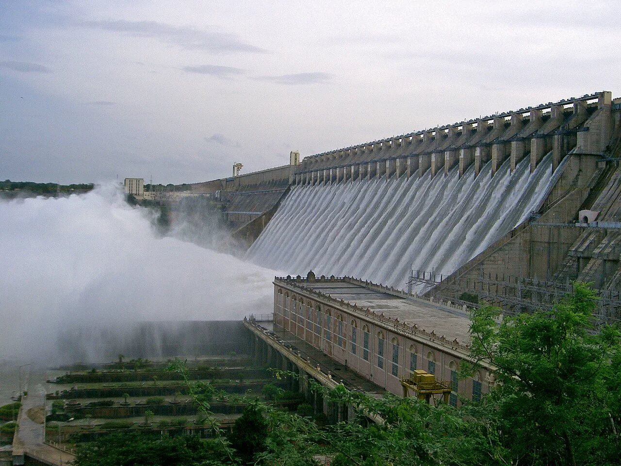
Nagarjuna Sagar Dam
Krishna River · World's largest masonry dam (Nalgonda/Palnadu).
Canals: Jawahar (Right) & Lal Bahadur (Left)
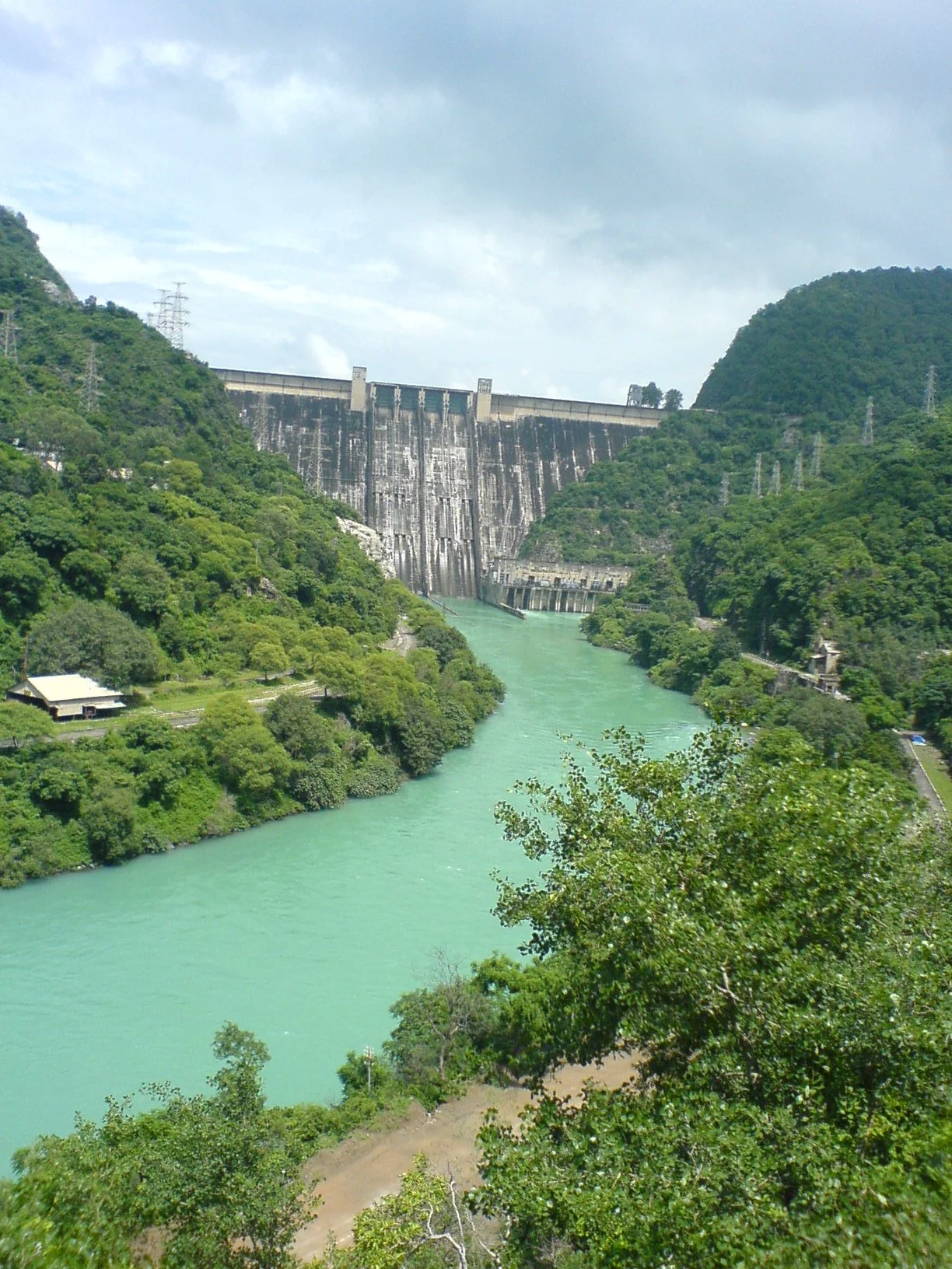
Bhakra Dam
Sutlej River · Highest concrete gravity dam (226 m) in India.
Reservoir: Govind Sagar (Himachal Pradesh)
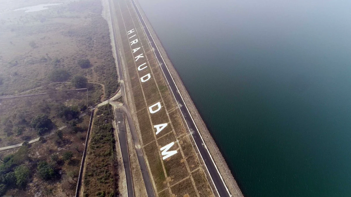
Hirakud Dam
Mahanadi River · Longest earthen dam in India (25.8 km total).
Sambalpur (Odisha) · Control of Mahanadi floods
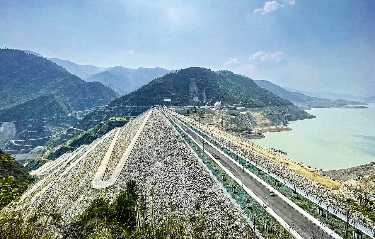
Tehri Dam
Bhagirathi River · Highest dam in India (260.5 m, Uttarakhand).
Confluence with Bhilangna · Rock & earth fill
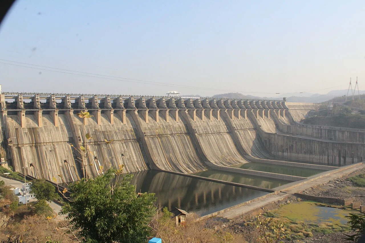
Sardar Sarovar Dam
Narmada River (Gujarat) · 4-state project with 458 km Main Canal.
Feeds drought-prone Saurashtra & Kutch
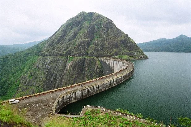
Idukki Dam
Periyar River (Kerala) · Double curvature concrete arch dam.
Between Kuravan & Kurathi granite hills
2. Major Canal Systems of India
Indira Gandhi Canal (Rajasthan Canal)
Originates from Harike Barrage in Punjab at the confluence of the Sutlej and Beas rivers. Runs ~650 km through Punjab/Haryana into Western Rajasthan (Thar Desert: Ganganagar, Bikaner, Jaisalmer, Barmer).
Sirhind & Western Yamuna Canals
Sirhind Canal: Takes off from Sutlej at Ropar (Punjab).
Western Yamuna Canal: Oldest canal in North India, originates from Tajewala/Hathnikund Barrage on the Yamuna (Haryana).
Buckingham Canal
796 km long freshwater navigation and drainage canal running parallel to the Coromandel Coast from Kakinada (AP) to Viluppuram (TN). Integrated with National Waterway 4 (NW-4).
Dowleswaram & Prakasam Barrages
Sir Arthur Cotton Barrage: Across Godavari at Rajahmundry (1852).
Prakasam Barrage: Across Krishna at Vijayawada (1957).
Canal Infrastructure & Take-off Headworks
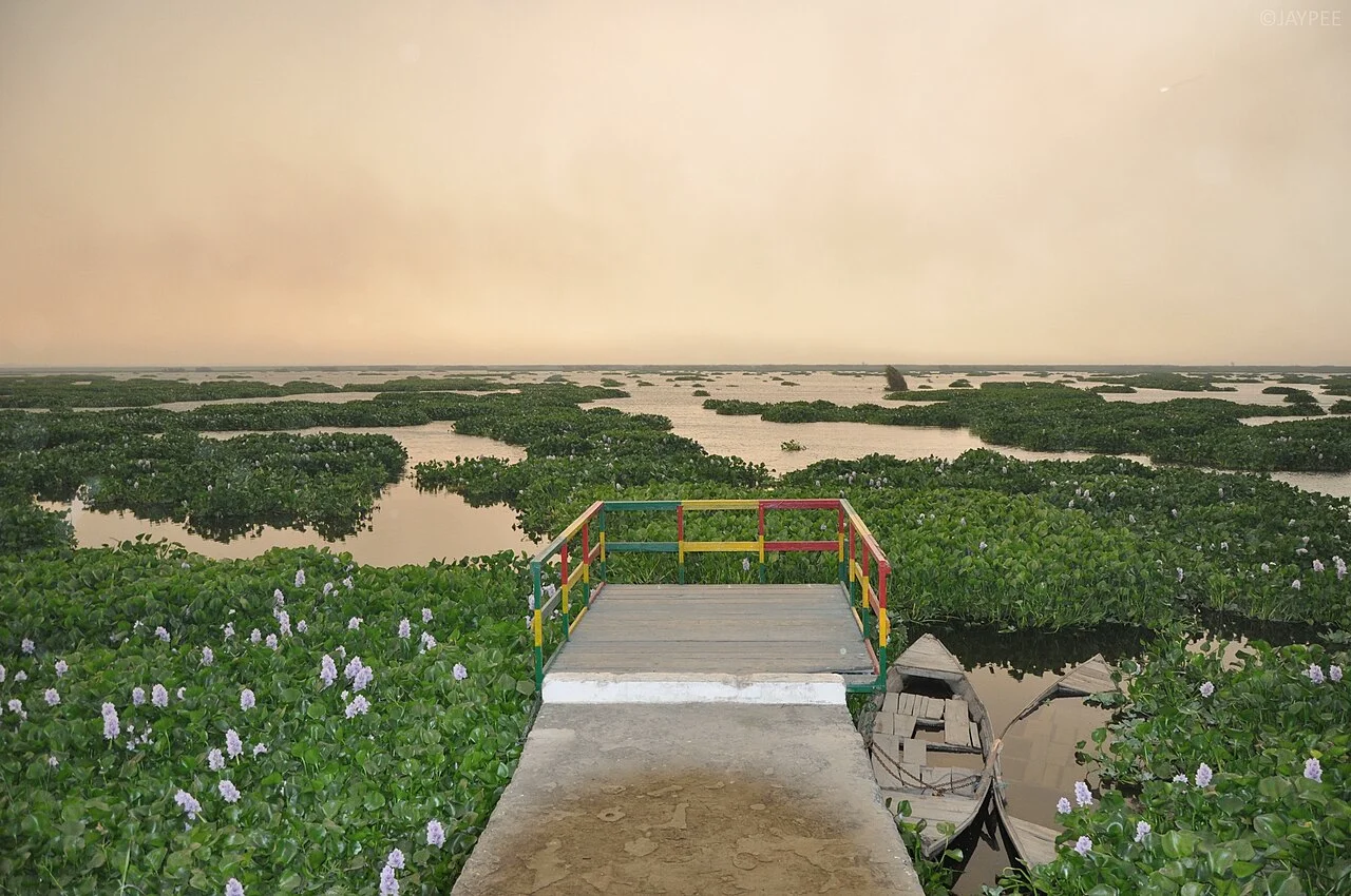
Harike Barrage (Punjab)
Origin of Indira Gandhi Canal at Sutlej + Beas confluence.
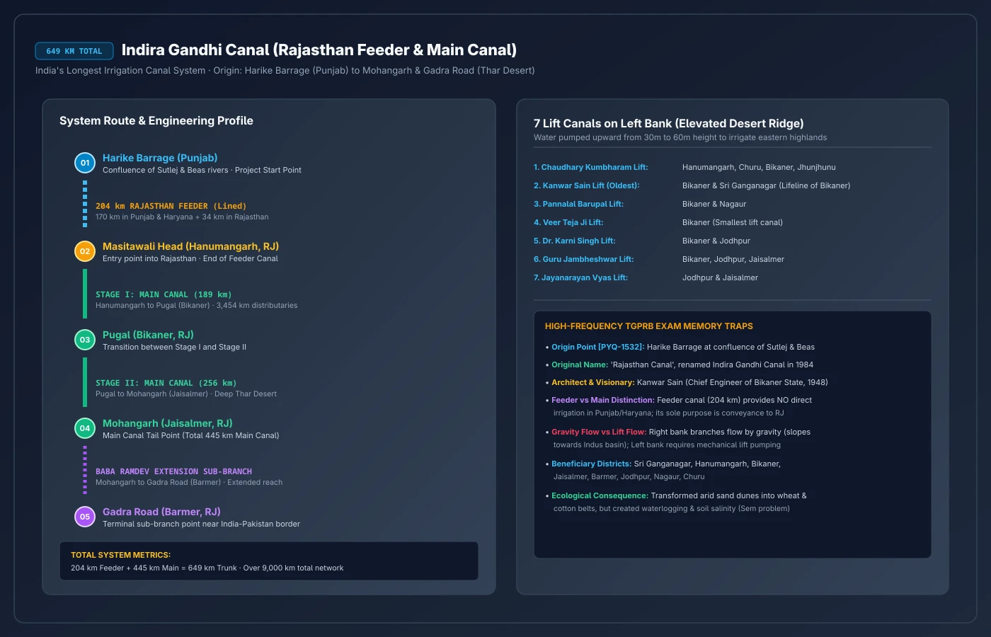
Indira Gandhi Canal Alignment
Route schematic showing Feeder Canal and Lift branches in Thar.
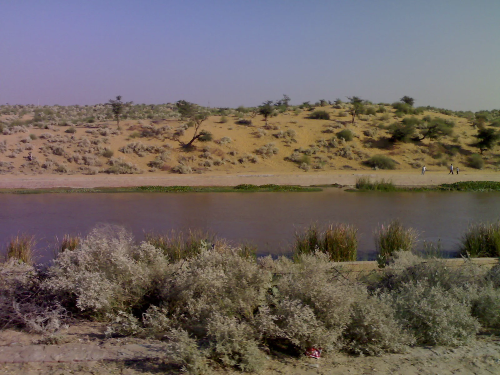
Desert Flow (Thar)
Canal bringing perennial Himalayan waters to Jaisalmer & Bikaner.
3. Telangana Lift Irrigation & Reservoir Systems
Telangana Special FocusBecause Telangana sits on an elevated plateau (300m–600m MSL), multi-stage lift irrigation is the primary engineering solution:
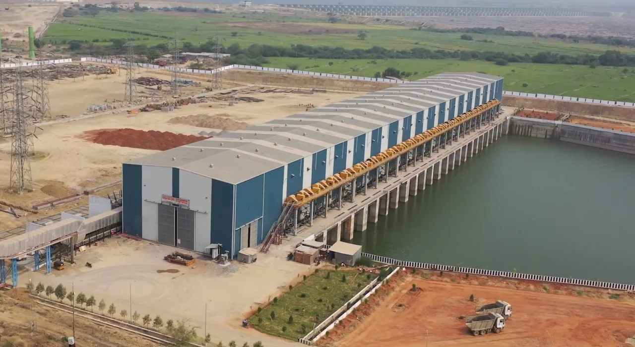
Kaleshwaram Lift Irrigation Project (KLIP)
World's Largest LiftDraws water from Godavari River at the confluence of Pranahita and Godavari at Kaleshwaram. Lifts water across 7 links and 28 packages through Medigadda (Lakshmi), Annaram (Saraswati), and Sundilla (Parvati) barrages to irrigate ~45 lakh acres.
Sriram Sagar Project (SRSP / Pochampad Project)
Constructed across Godavari River at Pochampad in Nizamabad district. Lifeline of North Telangana agriculture. Key canals: Kakatiya Canal (146 km), Saraswati Canal, and Laxmi Canal.
Rajolibanda Diversion Scheme (RDS) & Other Schemes
RDS: Anicut across Tungabhadra River supplying Jogulamba Gadwal and Raichur.
Priyadarshini Jurala: First project on Krishna River entering Telangana (Jogulamba Gadwal).
Mission Kakatiya: Flagship scheme to restore 46,531 minor irrigation chain-tanks across Telangana.
Data & Comparisons
Micro-irrigation and precision water delivery comparison matrix:
Drip vs Sprinkler Micro-Irrigation
| Feature | Drip Irrigation (Trickle) | Sprinkler Irrigation |
|---|---|---|
| Water Efficiency | 90–95% | 75–85% |
| Mechanism | Water drips slowly directly to root zone via emitters | Water sprayed under pressure into air like artificial rain |
| Ideal Terrain & Crops | Orchards, vegetables, cash crops, flat or terraced lands | Undulating terrain, sandy soil, tea/coffee, pulses, wheat |
| Key Advantages | Zero weed growth, minimal evaporation, fertiliser via fertigation | Cleans dust from leaves, frost protection, prevents soil erosion |
| Leading States | Maharashtra, Andhra Pradesh, Gujarat, Karnataka | Rajasthan, Haryana, Gujarat, Madhya Pradesh |
Pradhan Mantri Krishi Sinchayee Yojana (PMKSY)
Launched on 1 July 2015 with the motto "Har Khet Ko Pani" and "More Crop Per Drop". Amalgamated 4 central programs:
Fast-tracks major and medium multi-purpose dams and national canal projects.
Command Area Development (CAD), repair and restoration of water bodies.
Promotes micro-irrigation technologies (Drip & Sprinkler) and precision water delivery.
Soil & moisture conservation, check dams, rainwater harvesting, and runoff management.
* Micro Irrigation Fund (MIF): Dedicated corpus of ₹5,000 Crore established with NABARD.
Source: 4th & 5th Minor Irrigation Census (Ministry of Jal Shakti) and NABARD Annual Reports. 6th Census data compilation in progress as of 2025 · verify statistical allocations before exam.
Memory Hacks
Negative marking traps designed by exam setters to induce errors:
Trap 1: Govind Sagar vs Govind Ballabh Pant Sagar
• Govind Sagar: Formed behind Bhakra Dam on Sutlej River (Himachal Pradesh).
• Govind Ballabh Pant Sagar: Formed behind Rihand Dam on Rihand River (Uttar Pradesh). Largest artificial reservoir in India.
Trap 2: Highest vs Longest vs Oldest Dam
• Highest Dam: Tehri Dam on Bhagirathi (260.5 m).
• Highest Concrete Gravity Dam: Bhakra Dam on Sutlej (226 m).
• Longest Dam: Hirakud Dam on Mahanadi (25.8 km total).
• Oldest Dam: Kallanai Dam (Grand Anicut) on Cauvery, built by Karikala Chola (2nd century CE).
Trap 3: Polavaram vs Kaleshwaram River Association
Both mega-projects are on the Godavari River. However:
• Kaleshwaram: Multi-stage lift irrigation upstream at Medigadda (Telangana).
• Polavaram (Indira Sagar): Gravity dam downstream in Eluru/East Godavari (Andhra Pradesh, declared National Project under AP Reorganisation Act 2014).
PYQs
Every question below appeared in an official TSLPRB Constable or SI paper. Click an option to test your understanding.
Bhakra-Nangal project is constructed on the river
On which river is the 'Rajoli Banda Diversion Scheme' built ?
Match the following List - I Project a) Rihind b) Sileru c) Mettur d) Almatti List - II State i) Karnataka ii) Tamilnadu iii) Andhra Pradesh iv) Uttar Pradesh
On which of the following dates did Pandit Jawaharlal Nehru laid the foundation stone for the construction of the great Nagarjuna Sagar Project?
Examine the following statements: (a) The Indian Government approves corpus of ₹ 5,000 crore for setting up of 'Micro Irrigation Fund' (MIF) with NABARD under Pradhan Mantri Krishi Sinchayee Yojana (PMKSY). (b) The 'Micro Irrigation Fund' would substitute 'Per Drop More Crop' (PDMC) component of PMKSY. Choose the correct answer:
Which State has the largest irrigated area ?
Match the following List-I (a) Rajoliband Diversion Scheme (b) Sriram Sagar Dam (c) Lower Manair Dam (d) Kadam Reservoir List-II (i) Karimnagar (ii) Adilabad (iii) Mahabubnagar (iv) Nizamabad
Matatilla Project was built on which of the following rivers?
Match the following List - I a) Sardar Sarovar dam b) Highest mountain peak in South India c) Todas d) Copper List - II i) Anaimudi ii) Agnigundala iii) Narmada iv) Nilgiri
Ukai dam is situated across which of the following rivers?
Advanced Practice
TGPSC-Style Advanced Practice
These questions use multi-statement, 4x4 matching, and scheme verification formats from recent TGPSC Group-I patterns. TGPRB papers (2022-2023) remain 92-93.5% direct factual MCQs. These drills harden your policy and canal recall.
Source: Forensic Paper-Setting Evolution Audit, Aug 2026 - 1,350 questions classified across 7 papers.
Match the following lift irrigation projects/barrage with the rivers: List I (Project/Barrage): A. Mahatma Gandhi Kalwakurthy Lift Irrigation Project B. Nizam Sagar Project C. J. Chokka Rao Devadula Lift Irrigation Scheme D. Chanaka-Korata Barrage List II (River): I. Godavari II. Krishna III. Penganga IV. Manjeera Choose the correct answer:
Consider the following statements regarding Telangana irrigation projects: A. Koulasnala and Boggulavagu irrigation projects are located in the Godavari basin. B. Kotepally Vagu and Asif Nahar irrigation projects are located in the Krishna basin. Which of the above statements is/are correct?
Jal Jeevan Mission is a Government of India programme. Which of the following statements are correct about Jal Jeevan Mission? A. 'Har Ghar Jal' initiative was launched in 2019. B. Goa became the first certified Har Ghar Jal State in August 2022. C. Har Ghar Jal initiative is set to provide all rural households with safe drinking water through taps by 2025. D. More than 73.7% households are reported to have tap water supply as on 30.01.2024. Choose the correct answer:
Which of the following statements regarding the sources of irrigation in India are correct? A. Tube-wells and other wells constitute the largest source of net irrigated area in India (~62-64%). B. Canals form the second largest source of irrigation (~24-26%), with Uttar Pradesh possessing the largest canal network. C. Tank irrigation is predominantly practiced in the Peninsular region due to hard crystalline non-porous rock terrain. D. Micro-irrigation (Drip and Sprinkler) is promoted under the 'Per Drop More Crop' component of PMKSY. Choose the correct answer:
Match the following major canal systems with their headworks/source rivers: List I (Canal System): A. Indira Gandhi Canal B. Buckingham Canal C. Sirhind Canal D. Kurnool-Cuddapah (K-C) Canal List II (Headworks / Source): I. Sutlej River at Ropar (Punjab) II. Sunkesula Barrage on Tungabhadra River III. Harike Barrage at Sutlej-Beas confluence IV. Saltwater navigation canal along AP/TN coast
Comprehension Gate
Current Affairs
Current Affairs (1/99)
Union Environment Minister releases two male Great Indian Bustards into the wild at Desert National Park, Jaisalmer
Two male Great Indian Bustards were released into the wild at Sam in the Desert National Park, Jaisalmer, Rajasthan by Union Minister Shri Bhupender Yadav.
Union Minister for Environment, Forest and Climate Change Shri Bhupender Yadav released two male critically endangered Great Indian Bustards (GIBs) into the wild at the Desert National Park in Jaisalmer, Rajasthan. The Bustard Recovery Programme is a collaborative initiative involving the Ministry, Rajasthan Forest Department, and the Wildlife Institute of India.